

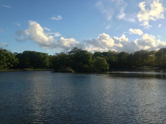
Beneath the iconic Dean Street in Newcastle flows a little-known river. The Lort Burn. The burn starts in two locations in the heart of Newcastle. The first tributary of the Lort Burn is the Victorian boating lake in Leazes Park which is one of the springs that sources the burn. The second tributary is where St Andrew’s Church is today, on Newgate Street. Originally the site of an Anglo-Saxon church, the stream that existed on the site was used to baptise the congregation.
The Lort Burn
The burn was particularly important in Newcastle’s early history because it provided a line of defence in the heart of the city. The castle was on a prominent rocky outcrop (the site of today’s Castle Keep and the Vermont Hotel) and had the Dean Burn flowing down towards the river. It was a fast-flowing medieval river and so provided an obstacle to attack.
In the Middle Ages, the stream was renamed the Lort Burn. It’s believed that this was because it became an open sewer during these times and Lort in Scandinavian languages means rubbish, waste or faeces.
Slightly further up, around today’s Lloyds Bank – previously called Anderson Place – the Lort Burn was a much more pleasant place to be because it wasn’t treated as a place to dump rubbish and sewage. Even further west and the Burn became a beautiful Northumbrian stream.
The Lort Burn was an open river right up until the late 1700s when Nathaniel Clayton – the father of John Clayton – culverted the stream to create Dean Street. Back then there were two parts to Dean Street. Lower Dean Street, which is what we call Dean Street today, and Upper Dean Street which was created as part of Grainger Town. Once Earl Grey’s Monument was built, they renamed the upper part of the Street to Grey Street.
The Lort Burn still flows under Dean Street today. We know this to be fact because back in 2012 when Thunder Thursday happened, we had the equivalent of two months’ worth of rain in a couple of day. Most of the drains in the area empty into the culverted river beneath the street. With nowhere to go due to an already overflowing Tyne River, the pressurised water pushed back up Dean Street and blew a manhole cover off in the street.
Pandon Dene
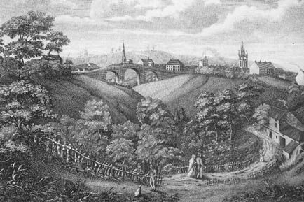
The Pandon Dene ran north to south from where the Hancock Museum stands, through the heart of the city, to the quayside. It was considered an area of amazing natural beauty – a location where local residents retreated from the city to enjoy the fresh air, peace and quiet. Imagine today’s Jesmond Dene, only it was much closer to the city.
Unfortunately, the early industrialists in the late 1700s to early 1800s considered the dene to be standing in the way of progress so they filled the entire dene in. Over the course of around 20 years, the dene was entirely lost to the city. Today’s Civic Centre, Northumbria University and the central motorway all stand on the site of the old Pandon Dene.
The dene itself was culverted and runs into the Tyne through a small exit pipe around where the Law Courts stand on the quayside.
The Skinner Burn
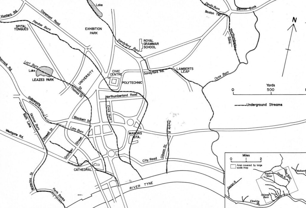
The final of Newcastle’s lesser-known rivers is the Skinner Burn. It runs roughly between the site of the Centre for Life and the Jury’s Inn. In the past, this burn was the boundary between the town of Newcastle and the township of Elswick.
As another culverted river, not many people know that there’s still a river flowing beneath the modern-day city from north to south.
Back in the Middle Ages and the industrial era, the river would have been much more prevalent in this area because there was the White Friar’s Monastery just past where the Centre for Life now stands, as well as the Hawthorn locomotive manufacturing Works.


